Engineering Custom Systems for Enterprise Scale
We deliver mission-critical solutions across Geospatial, AI, Industrial Systems, and Digital Integration—proven at national scale.

Four Core Solutions
Specialized expertise where precision engineering meets enterprise requirements
Geospatial Systems
Advanced GIS platforms tailored for spatial analysis, asset tracking, and infrastructure management—engineered for enterprise-grade scale.
AI & Data Intelligence
Production-ready AI and data intelligence systems for forecasting, anomaly detection, and decision support—engineered for governance, reliability, and measurable outcomes.
Industrial & Supply Chain
End-to-end industrial and supply chain systems for real-time operational visibility, inventory control, and logistics optimization—engineered for uptime, performance, and auditability.
Digital Engineering
Integration-first digital engineering for modern APIs, legacy interoperability, and secure data flows—engineered with scalable architecture, observability, and long-term maintainability.
Industries We Serve
Deep domain expertise across critical infrastructure and industrial sectors
Military
Mission-critical systems for situational awareness, operational readiness, and secure information management.
Government & Public Sector
Integrated government systems for planning, operations, spatial decision-making, and service delivery.
Manufacturing
Manufacturing systems for production execution, quality assurance, asset maintenance, and operational analytics.
Logistics & Supply Chain
Warehouse and logistics systems for inventory visibility, distribution operations, and end-to-end supply chain control.
Retail & Market Intelligence
Analytics and decision systems for retail-market visibility, performance tracking, and insight-driven execution.
Agribusiness & Commodities
Systems for plantation operations, commodity traceability, procurement-to-distribution workflows, and reporting.
Proven at Scale
Real problems solved with engineered solutions
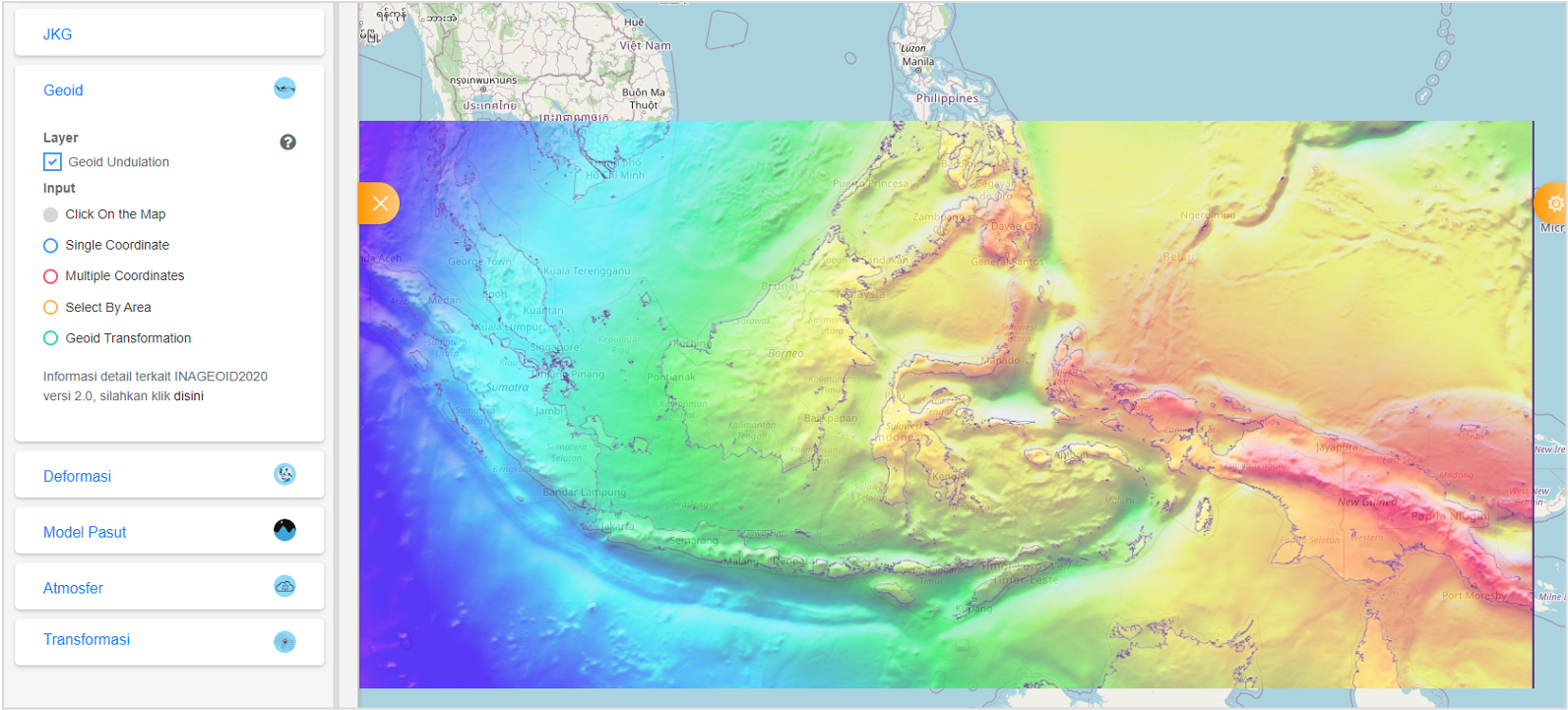
Sistem Referensi Geospasial Indonesia (SRGI)
SRGI is a multi-discipline application which provide integrated portal for various spatial reference-related information. Use heavy spatial operations and calculations.
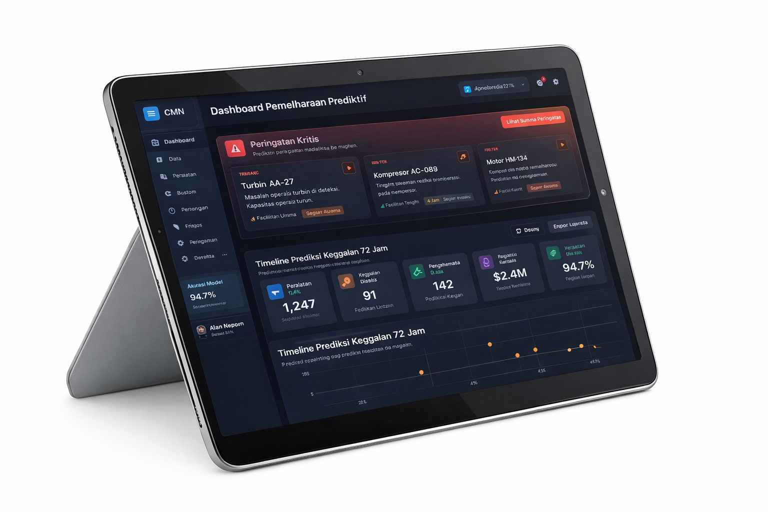
Predictive Maintenance AI
Machine learning system predicting equipment failures 72 hours in advance across multiple production facilities.
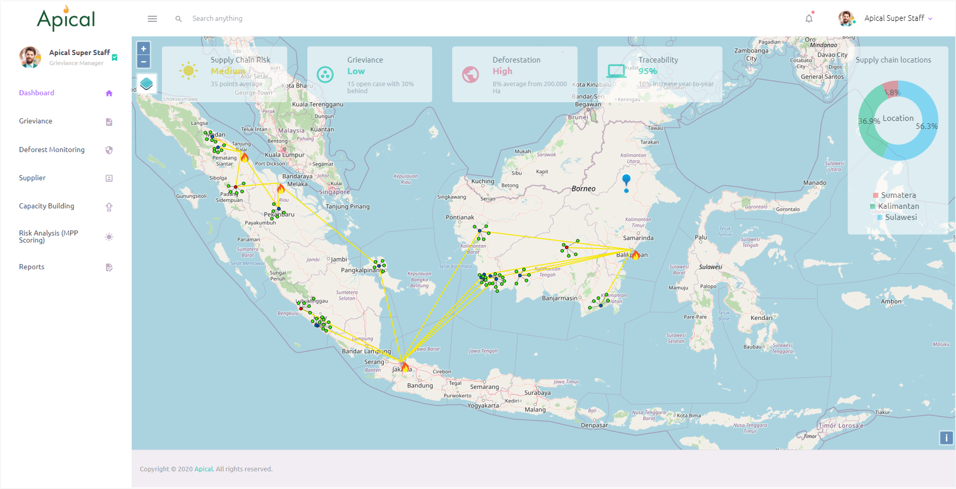
NDPE Management Platform
NDPE (No Deforestation, No Peat, No Exploitation) management platform for palm-oil supply chains—grievance handling, deforestation monitoring, supplier mapping, and traceability dashboards.
Trusted by Leading Organizations
Government agencies, utilities, and industrial enterprises


Ready to Build Your Next System?
Let's discuss your technical requirements. Schedule a consultation with our solutions team to explore how we can deliver the system you need.