Geospatial Systems (GIS)
Custom GIS solutions—from simple mapping to enterprise-grade, multi-platform systems

Custom GIS Platforms (Web & Mobile)
Sintesa delivers custom GIS across the full spectrum—from focused mapping workflows to enterprise-grade platforms with governance, high availability, and national-scale performance. We engineer data models and user workflows that match how teams operate across web and mobile, and integrate satellite imagery, real-time GNSS/telemetry, and high-volume POI datasets when the use case requires it.
Key Technologies
Typical Use Cases
- ●POI & asset inventories with map-based data entry
- ●Basic layers, search, filters, and dashboards
- ●Light integration (CSV import/export, simple APIs)
- ●Field inspections, work orders, and audit trails
- ●Mobile apps with offline sync and task-focused UX
- ●Real-time location hooks for crews, assets, and devices
- ●Enterprise asset & infrastructure registries
- ●Utility network operations (planning, outages, maintenance)
- ●Satellite imagery / change detection workflows
- ●Real-time GNSS and field telemetry monitoring
Related Case Studies
Sintesa portfolio of GIS delivery across real enterprise programs
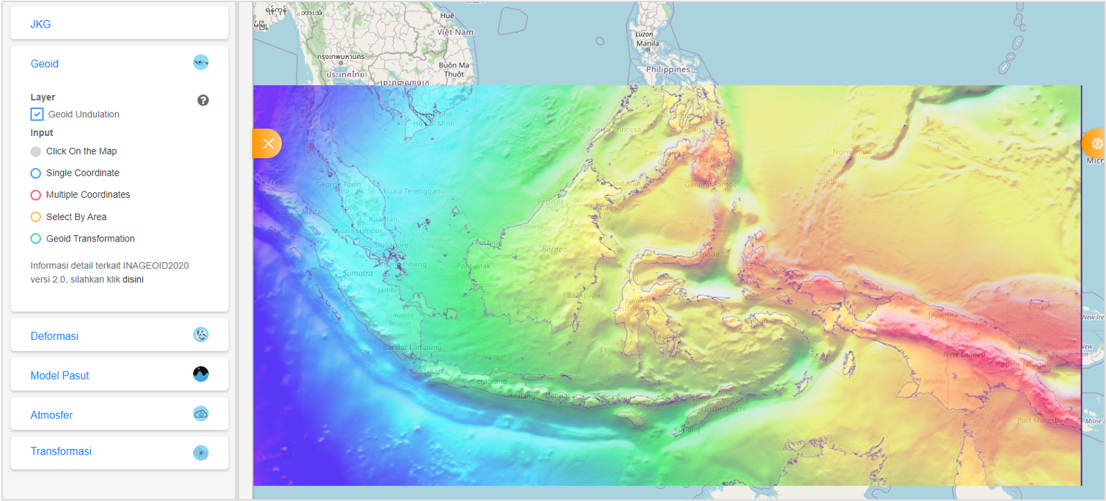
Sistem Referensi Geospasial Indonesia (SRGI)
SRGI is a multi-discipline application which provide integrated portal for various spatial reference-related information. Use heavy spatial operations and calculations.
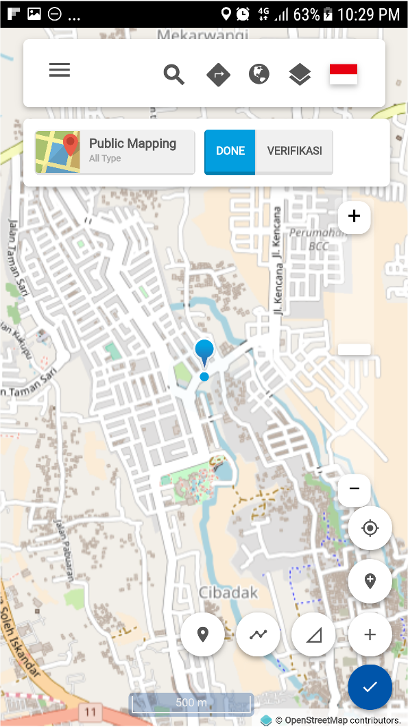
Collaborative Mapping Platform
Users can participate in global mapping, add point-of-interest interactively. Use by BIG, BNPB, KEMENDES, various communities for disaster response and community mapping.
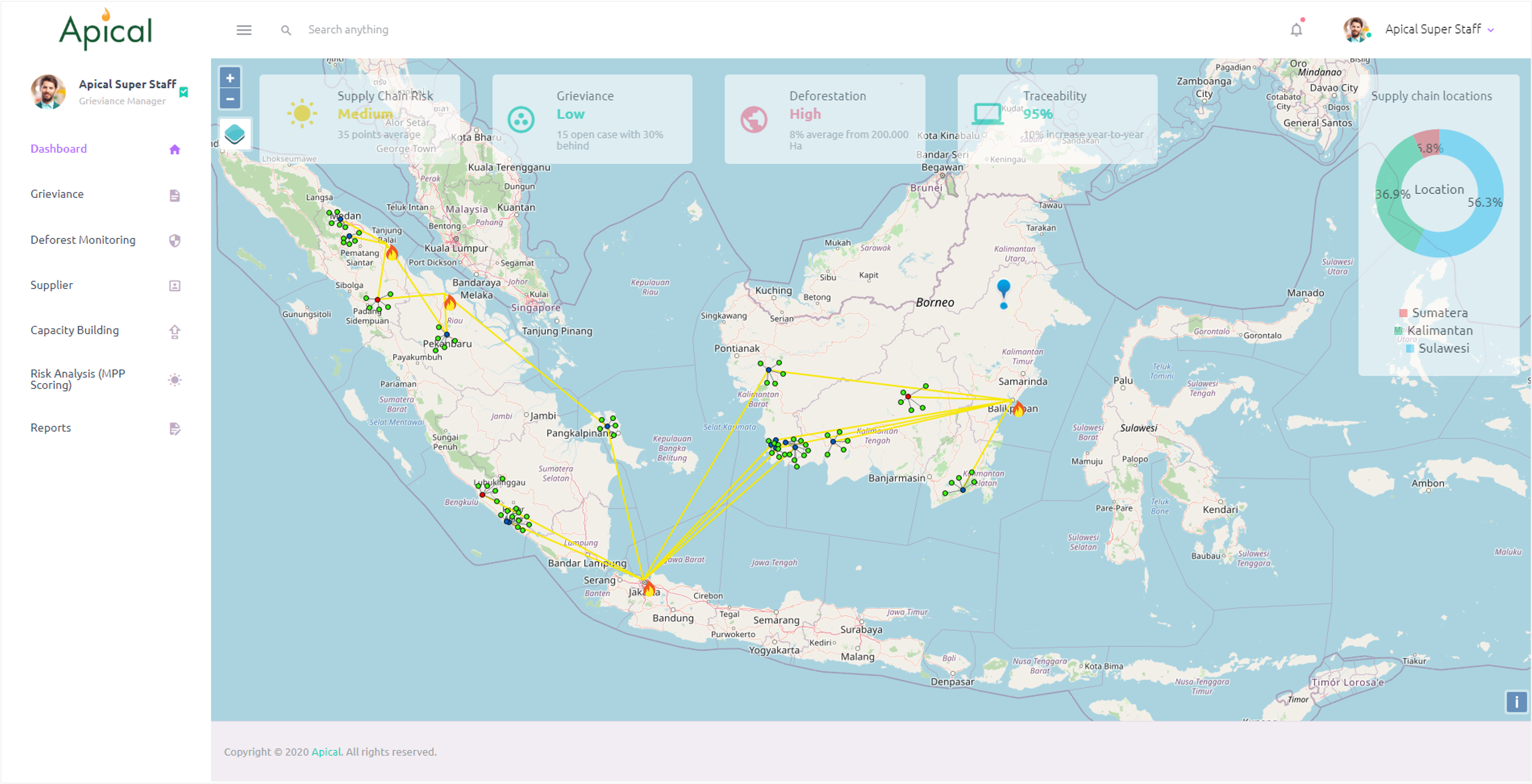
NDPE Management Platform
NDPE (No Deforestation, No Peat, No Exploitation) management platform for palm-oil supply chains—grievance handling, deforestation monitoring, supplier mapping, and traceability dashboards.

Elektronik Leger Jalan
Build solution for Kementrian PUPR to manage leger data. System features many endpoint access, and provide geospatial statistics for national road infrastructure.
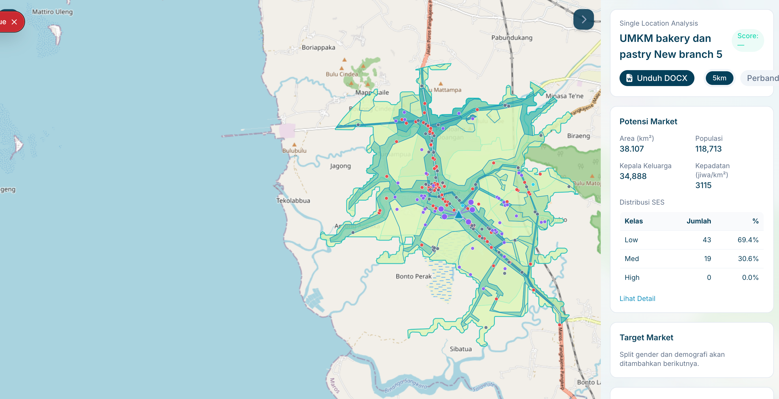
Location Intelligence
Delivered a map-first operations console for analysts and agencies to run location analyses, compare candidate sites, and export decision-ready outputs with documented performance targets.

Depo Plumpang Mapping
Spatial map of depo plumpang for PT Pertamina. Layering data with custom information such as drone photos and 360 photos for comprehensive facility management.
Ready to Discuss Your GIS Solution Requirements?
Schedule a technical consultation with our solutions team. We'll analyze your requirements, recommend the right approach, and provide a detailed implementation roadmap.