Case Studies: Real Problems, Engineered Solutions
Explore how we've delivered mission-critical systems across Geospatial Intelligence, AI Analytics, Industrial Operations, and Digital Integration for government agencies, utilities, and enterprises.

Market Survey Management System
Survey management platform to coordinate retail-market surveyors across Indonesia and deliver validated data to clients, with location-based features such as absence, geo-location, and surveyor trails.
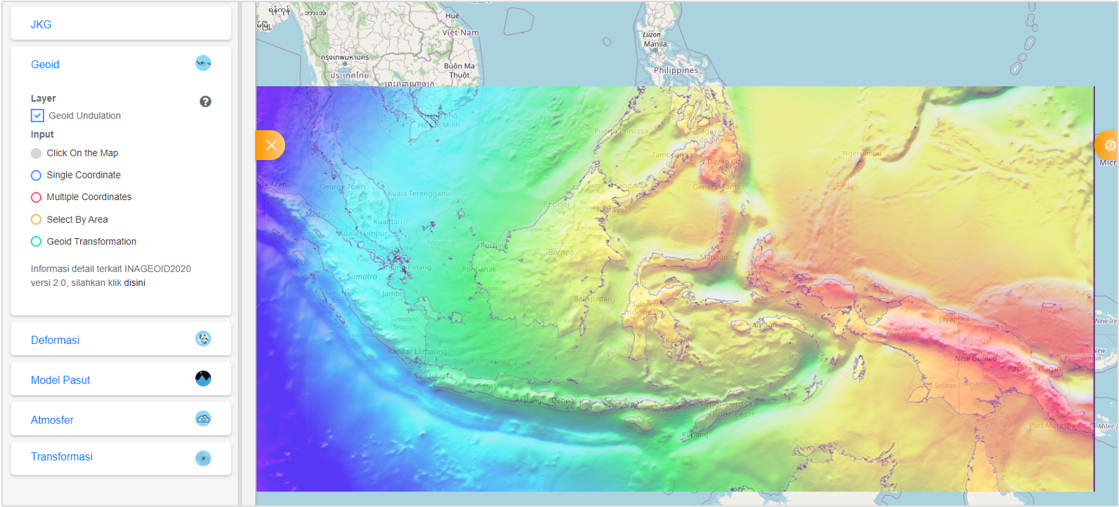
Sistem Referensi Geospasial Indonesia (SRGI)
SRGI is a multi-discipline application which provide integrated portal for various spatial reference-related information. Use heavy spatial operations and calculations.

Warehouse Management System (WMS) + Manufacturing Execution System (MES)
Proven system for high-load high-availability process. Using android based industrial scanner. Integrated system from receiving, until finished. Deploy on premise or cloud.
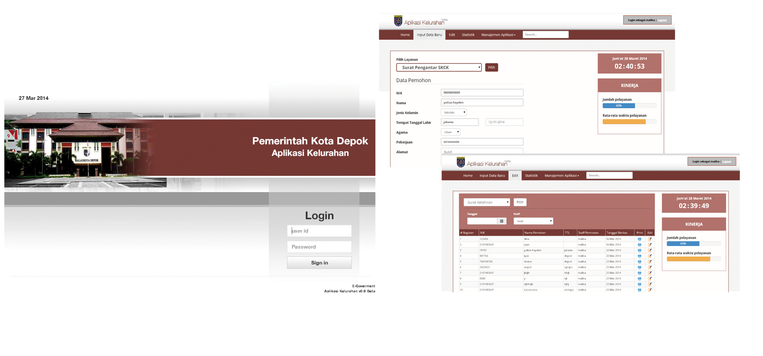
e-Kelurahan Digital Transformation
One of the pioneer in Depok city digital transformation in eGovernment. Use by government of Depok to provide efficient and effective public service.
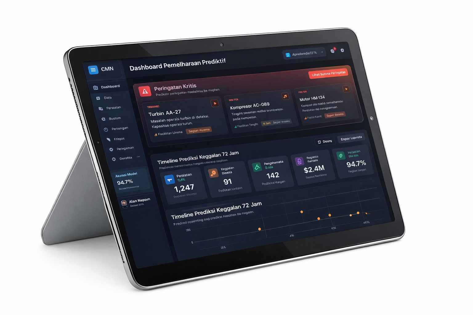
Predictive Maintenance AI
Machine learning system predicting equipment failures 72 hours in advance across multiple production facilities.
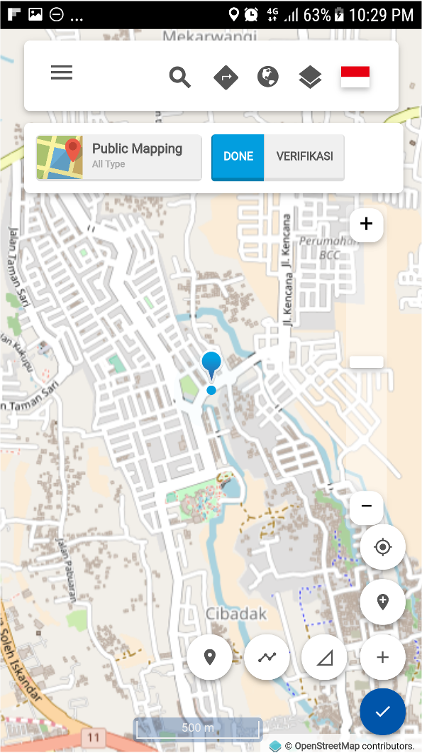
Collaborative Mapping Platform
Users can participate in global mapping, add point-of-interest interactively. Use by BIG, BNPB, KEMENDES, various communities for disaster response and community mapping.
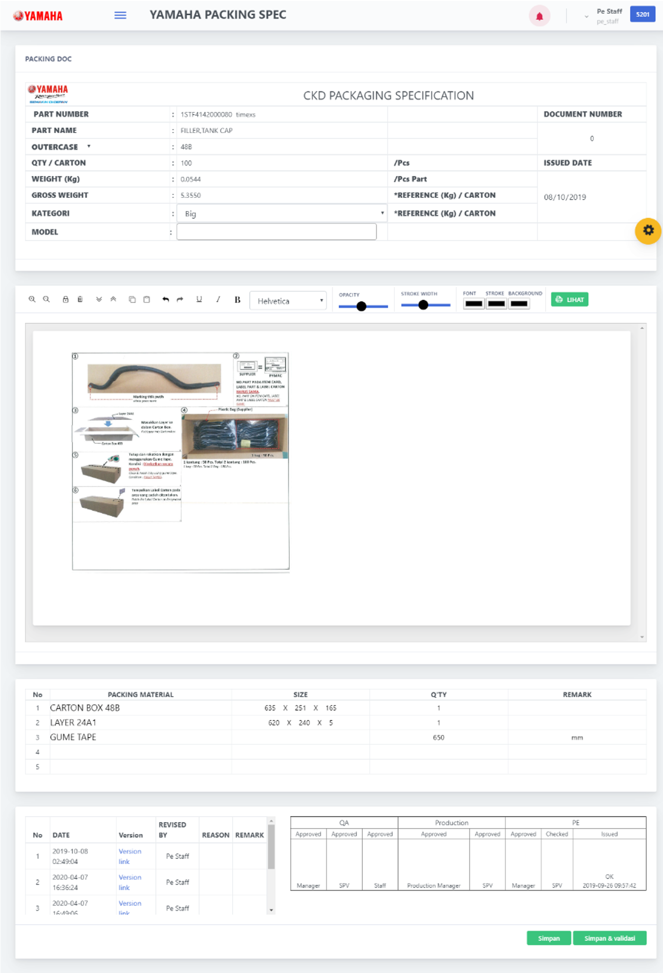
Manufacturing Technical Document Creation and Approval System
Build solution for PT Yamaha Indonesia Motor Manufacturing internal technical document. Including 5 tier approval system across related divisions.

High Availability Network & AGV System
Design Enterprise Industrial Network with 99.9% SLA. Implement Network with Enterprise Device for Automated Guided Vehicle (AGV) for PT Honda Precision Part Manufacturing.

SMS Gateway for Agriculture
National-scale SMS gateway platform supporting broadcast and operational messaging for public-sector programs and field communications.

Supply Chain and Sales Solution
Supply chain management from procurement to warehouse and beyond, plus mobile apps for sales and partner management to improve execution and visibility.
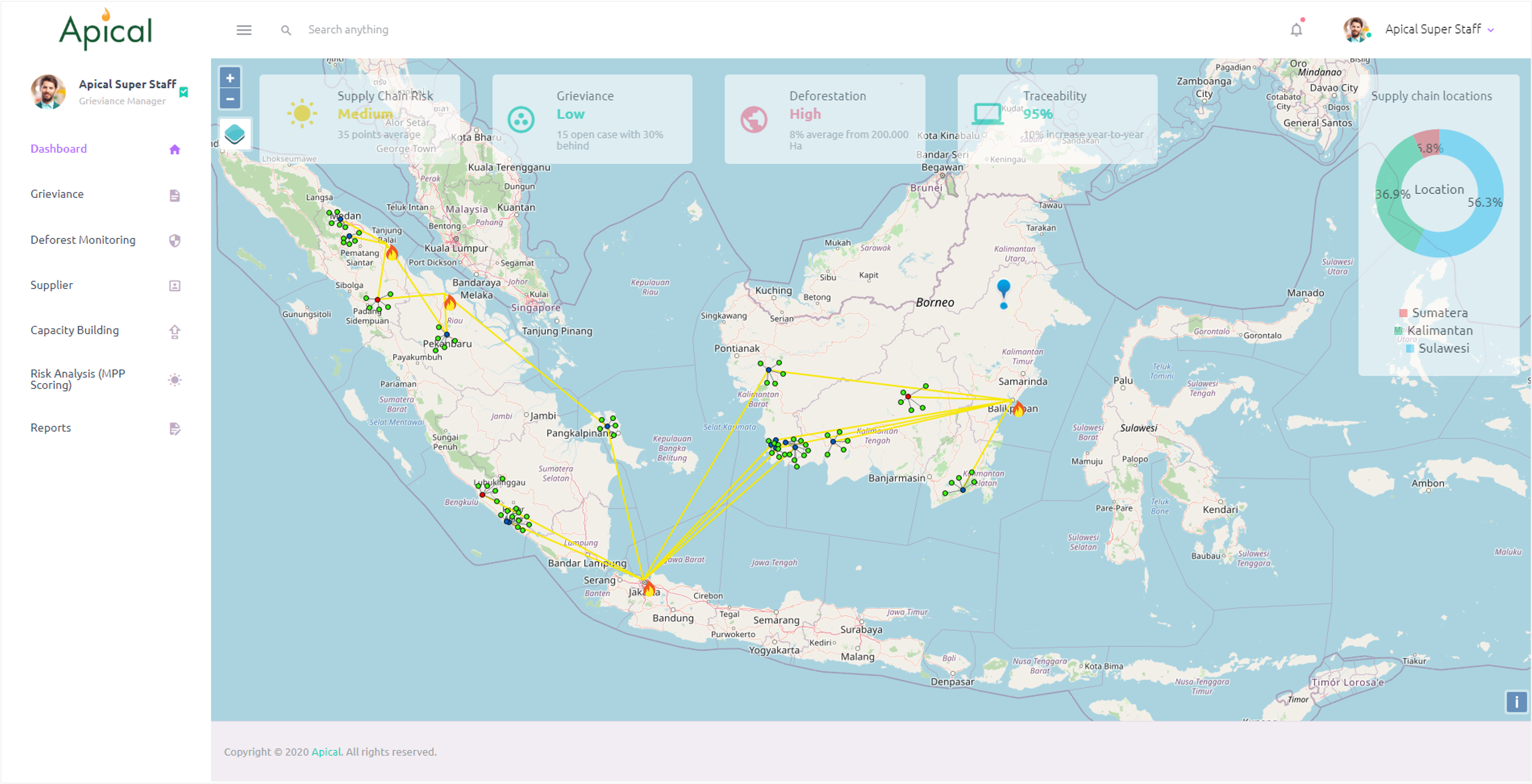
NDPE Management Platform
NDPE (No Deforestation, No Peat, No Exploitation) management platform for palm-oil supply chains—grievance handling, deforestation monitoring, supplier mapping, and traceability dashboards.
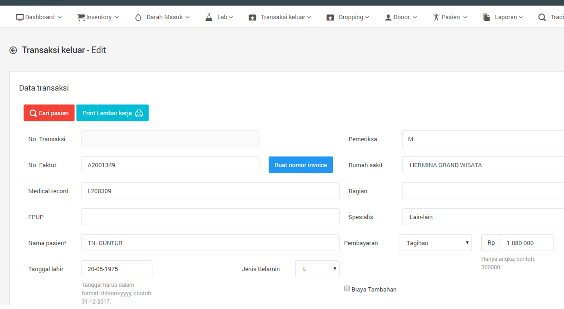
Blood Management System
Barcode-based blood management system to streamline the blood processing lifecycle—from donation to distribution—integrating lab workflows and time-sensitive traceability.

Logistic Information System
Track & trace platform for digital postal operations—shipment lifecycle management, status updates, and delivery visibility with configurable workflows.

Gema AI Vision inspection UI for line operations
An AI vision quality inspection system, used by plant supervisors to monitor station results, review NG evidence, and export shift-level summaries.
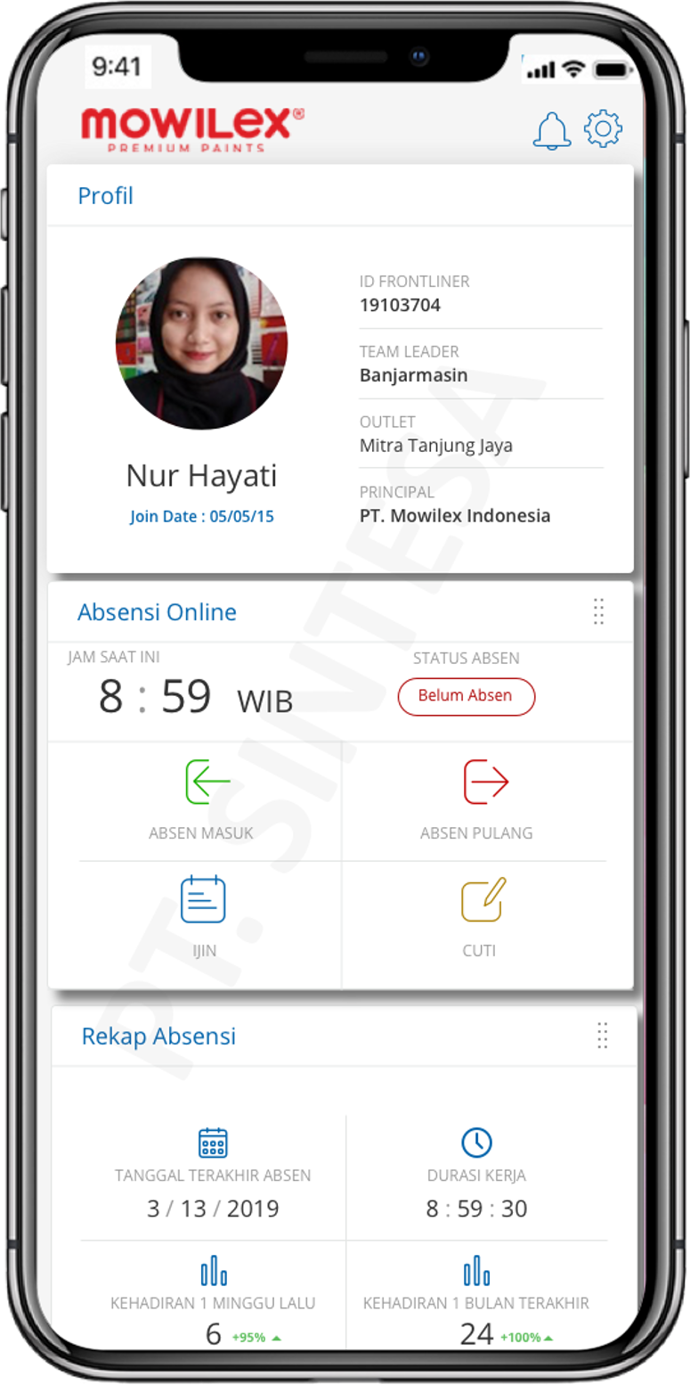
Sales Improvement & Monitoring Platform
Mobile-first platform for field attendance and performance monitoring with geo-boundaries, historical tracking, and operational reporting for sales teams.
RFID Document Tracking System
RFID-based document tracking and monitoring system to trace missing documents, reduce human error, and provide operational dashboards for system and user management.

Elektronik Leger Jalan
Build solution for Kementrian PUPR to manage leger data. System features many endpoint access, and provide geospatial statistics for national road infrastructure.
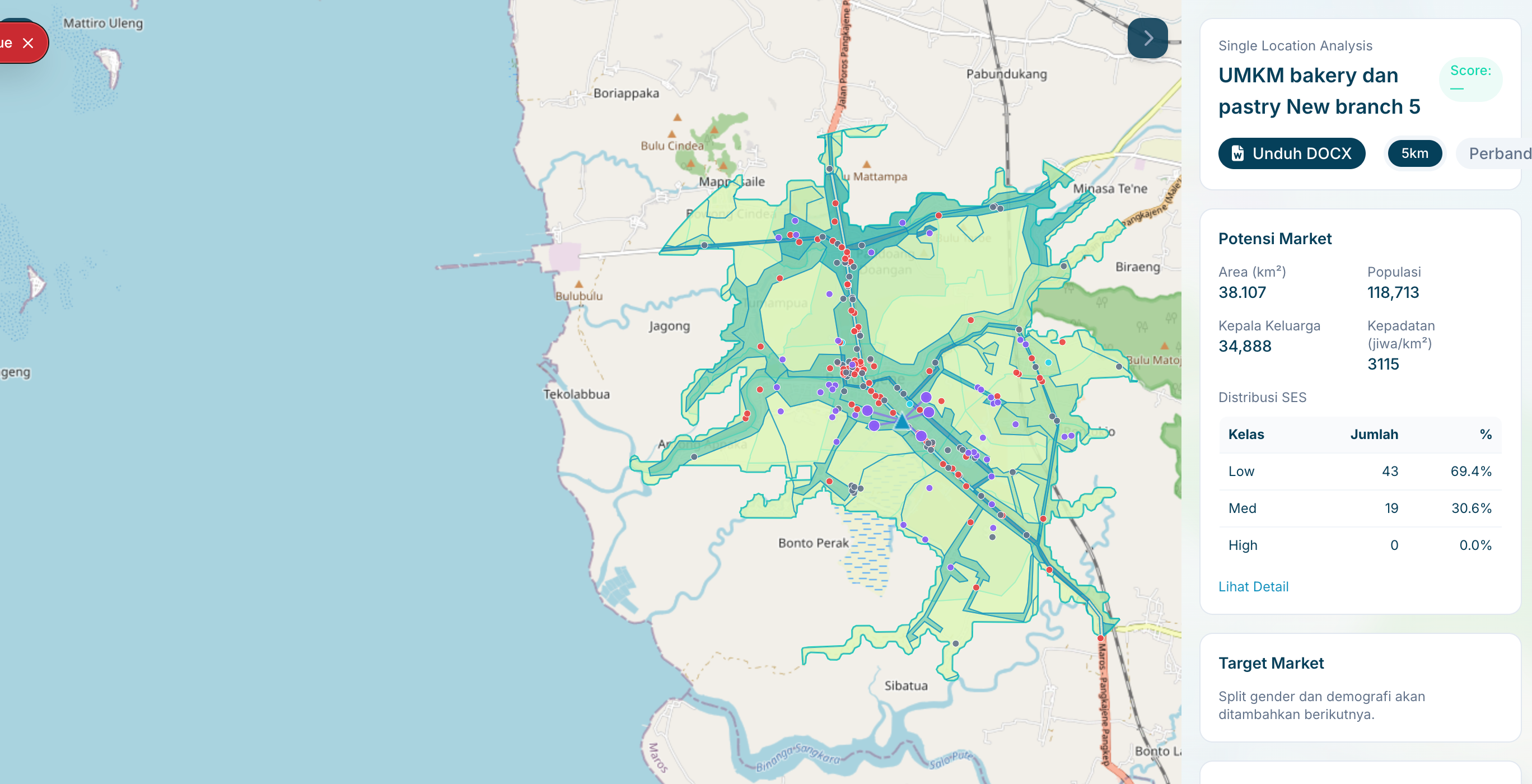
Location Intelligence
Delivered a map-first operations console for analysts and agencies to run location analyses, compare candidate sites, and export decision-ready outputs with documented performance targets.

Depo Plumpang Mapping
Spatial map of depo plumpang for PT Pertamina. Layering data with custom information such as drone photos and 360 photos for comprehensive facility management.
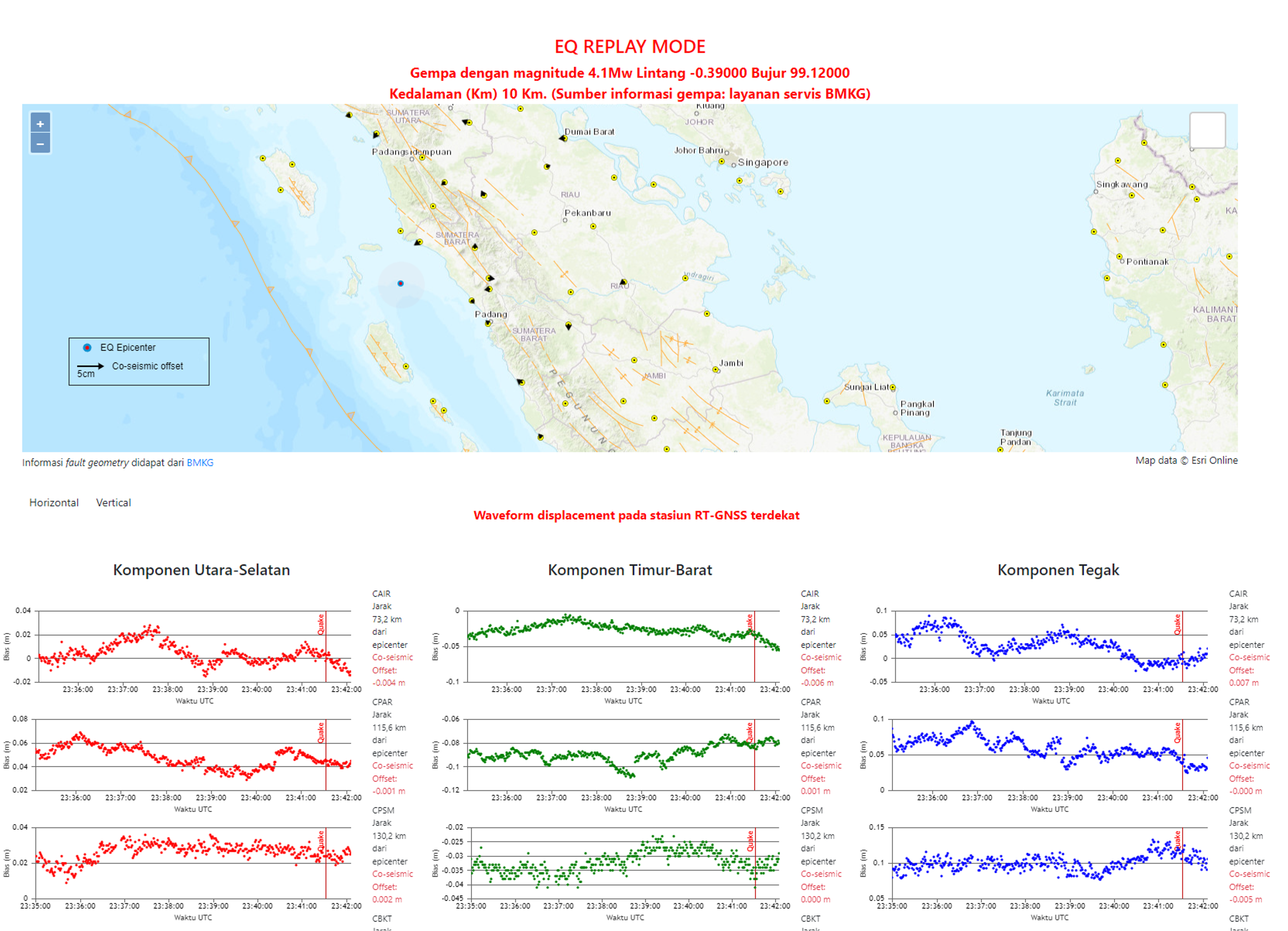
Earthquake GNSS Realtime Monitoring
Realtime earthquake replay and GNSS displacement monitoring—integrating seismic event data and station waveforms for rapid analysis and situational awareness.
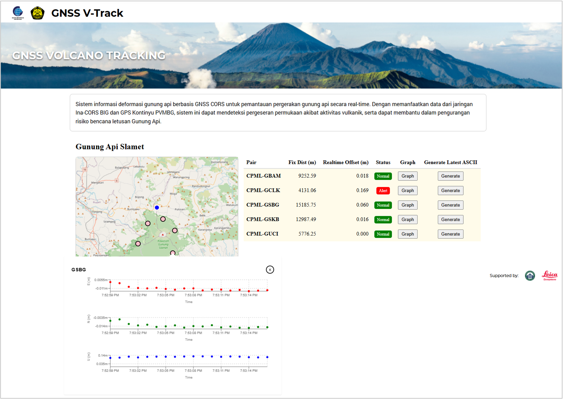
GNSS Realtime Volcano Monitoring
Volcano deformation monitoring using realtime GNSS coordinate displacement calculations—supporting early warning, forecasting, and disaster risk reduction for active volcanoes.

Corporate Website (Bali International Flight Academy)
Corporate website designed and built with target-market analysis, content structure, and performance-focused implementation for a private pilot academy.

Multi-location Inventory & Logistics Management
Custom solution for managing goods across multiple inventory, distribution, and sales points—barcode-based identification with mobile and scanner data acquisition, deployed as a SaaS platform.

Supply Chain Visibility Platform
Integrated warehouse and transportation management with real-time tracking of daily shipments and operational KPIs.